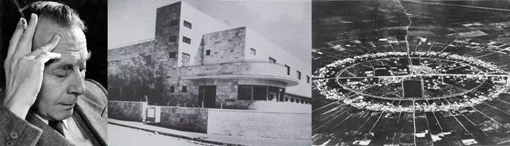
Editor’s Note: The following article, written by Richard Kauffmann, describes his 1925-26 plan for the Haifa-Acre region and how the current problems could have been avoided had the plan been implemented. The article was translated to Hebrew and published by Masada (Tel Aviv) in 1952. Scanned images of the Masada article were provided by the Central Zionist Archives, Private Collections Department. These were first transformed into Hebrew text using OCR and then translated to English by this writer. More text will be added as the translation progresses.
Note to reader: If you have a copy of the original version of this article, (in English or German) please contact me at rK.ekf@verizon.net. If it can be obtained by us, a lot of unnecessary effort would be eliminated and greater accuracy obtained.
_________________________________________________________________________

After the First World War, in the early intensive development of our country, it became clear to those who understood the issue – although they were few in number – that there is probably no other area in our country like the area spreading from Haifa to Acre, which, because of its location, demands organic development, and therefore requires regional, comprehensive and far-sighted planning.
In those days Haifa was still a small town, and there were only a limited commercial district and the German Colony. Hadar-Hacarmel was in the beginning of its construction. The small town of Haifa has developed in the narrow strip between the sea and the slopes of Mount Carmel. Because of the absence of a suitable port, the ships docked opposite this strip, in the protected part of the bay. The greater Kishon Valley was almost entirely an extensive unpopulated, malaria-infested, wetlands area.
Lasting credit is due to the late Joseph Levy, who was the first to understand the full meaning and importance of the Zebulun Valley to Haifa’s future development. He succeeded in instilling his passion and faith in two other men of action, Mr. Ephraim Kotznok and Mr. Fasman, and the three founded “Haifa Bay Development Company”, and approached with great energy and dedication the pioneering work of land acquisition and development. Planning the entire area was then given to the writer of these lines.
From the beginning it was clear to me that the extensive areas that were purchased by the Haifa Bay Development Company with their incidental borders will be only part of the area that the planning has to include. I saw that one must organize and plan the whole wide area, from Haifa with the Carmel in the South to Acre in the North, an area of 250 square kilometers or 250,000 dunams.
The topography of the Carmel and its adjacent areas has been copied from existing surveys, while in Haifa Bay itself, which is the main area, excellent topographic measurements were made by the late engineer Joseph Treidel. For the purpose of the planning itself, I installed a special planning office on Mount Carmel, which at its disposal were the engineers, as consultants, Joseph Levy, Shimon Reich, Joseph Treidel, and also engineers expert in port construction, and more.
Basic factors in the delineation of the planning
Many have already dealt with the special geo-economic situation of Haifa and there is no need to go back and raise it here. It is possible to assume that these facts are quite well known. We should mention only one thing again – that of the singular and unique role known to this place by its being the natural gateway to our country from the countries of the sea, and the place of intersecting international transport lines north-south (Europe, Middle East, Africa) and from west to east (Sea countries – Transjordan, Iraq, etc.). These factors alone were sufficient to ensure the most intensive development. Added to this is the recognition that Haifa would be both the natural and logical center of a fertile agricultural area and an area of light and heavy industry.
Indeed, at that time, we did not have an accurate survey to predict the dimensions of development in the future, but the natural data were so convincing in the direction they want you to go, and in contrast to this what little existed was so non-organic and detrimental to development, that the role and purpose of planning were made clear as if by themselves.
Therefore we will first review what existed as we found it previously, next we’ll talk about the role and purpose we put before us, the attempt to solve the problems in designing the program and its implementation, and finally the problems we face today.
What we found
As I said above, Haifa in the early twenties was only a small town, with a population of 20,000 persons, spread over a built area of one square kilometer. The town was located in the narrow “bottleneck” between the seacoast and the foot of the northeast slope of the Carmel. On the Carmel itself stood only the few houses of the Templars, especially on the “German Carmel”.
The train tracks and international road had been simultaneously placed around the Carmel finger and cut across the city of Haifa through all its length.
Industrial plants almost did not exist. The “Nesher” cement plant and the “Shemen” oil factory were at the beginning of their development and still had not had time to expand.
Roads connecting to the North did not exist yet. Because of the lack of a port the ships anchored in the Gulf. Thus the Mandatory Government decided to have a port built by the British port building company: Palmer, Triton and Randall, and indeed the future location of the port was planned the opposite the existing town.
Out of a complete lack of understanding of the nature of town planning, the possibility was given to buy land around the existing town to the south – west and south – east, on the steep slopes of Mount Carmel, for the construction of residential neighborhoods, instead of leaving the slopes free of construction and designating them for forestation. A master plan did not exist for planning the town and therefore the entire development was most anarchic.
Roles and Goals of our Planning
Cut out those failure-causing beginnings, eliminate the anarchy and transfer the development to natural, healthy and organic tracks – that was the role and purpose of our planning. It was clear to us beforehand that the port in the proposed location, without concern for enough “Hinterland”, without concern for creating one organic body – port town – and without concern for possible expansion of this body thereafter – such a seaport is a grave mistake that inevitably would backfire on itself severely in any future development. The building of the port in the proposed place would have brought about the conglomeration (agglomeration) of the town in a narrow strip with all the damages associated with it, for health, fitness and efficiency of its residents.
To the planner it is obvious that the port “dwells not alone” and it is impossible for it to live its life totally cut off, but rather it is a necessary link, albeit the most important, among the vertebrae that make up the organism of the port city.
In the absence of enough hinterland, without organic connection tailored to the essential transportation systems, to the business and residential districts of the city, it is destined that any possibility of rational and successful service of the port would be hit hard, and that would be a serious injury to the whole city.
The port plan, as proposed by the Mandatory Government, west of the town, was prepared without taking into account this organic connection and without synchronization with the other vertebrae of the city body. Attention was not given except for professional methods of the building of a port: low construction costs, and certainly for strategic reasons. This plan posed a threat to the organic economic development of the whole region.
Based on the above, it seemed obvious that the natural and desirable place for the port was in the south – eastern part of the bay, near the mouth of the Kishon River, with the wide flat hinterland and the most appropriate area for the establishment of the working city, i.e., business and industrial areas, neighboring the port, would naturally be the broad and unpopulated Zevulun Valley.
The transportation lines, the international roads and the train-tracks, leading to the city from the south and passed around the Carmel finger and split the urban area, all this should have been transferred to another place, so that they will surround the city toward the east.
We wanted to avoid the danger, which threatens construction on the steep slopes of the Carmel and to achieve the goal of preserving them for the goal of protection of public green areas.
We wanted to protect Old Acre – an architectural gem – from modification and ugliness, while proposing a suitable area for the development of the New Acre.
Regional Diagrammatic Sketch
Except for a few detailed plans for individual neighborhoods, there was not any master plan for Haifa, let alone for Acre. In those days there still had not been created institutions that would strive for such planning and move towards its implementation. Engineer Levy, acting on behalf of the Haifa Bay Development Company”, was easily convinced of the need for having this kind of comprehensive planning, and therefore we went for making the planning for the whole area.
Our intent was to work on the initial plan in connection with the
(Ed. To be continued…)